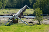
Foundry SpatialManaging Extreme Rainfall at Pipeline Water CrossingsEnsuring pipeline integrity can be a challenge when it comes to dynamic river conditions and remote infrastructure. Across North America…Mar 18Mar 18
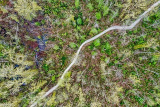
Foundry SpatialinThe BoilerResearch Into Action: Foundry’s New ECA Module!Understanding forest disturbance in BC’s WatershedsJun 3, 2022Jun 3, 2022
Foundry SpatialinThe BoilerFoundry Spatial Collaborates with The Nature Conservancy and Trout Unlimited in CaliforniaFoundry Spatial is teaming up with The Nature Conservancy and Trout Unlimited to address California’s most pressing water management…Nov 10, 2021Nov 10, 2021
Foundry SpatialinThe BoilerResearch Summary — Too Many Streams and Not Enough Time or Money?Efficient understanding of streamflow depletion — research, results, and recommendations.Oct 22, 2021Oct 22, 2021
Foundry SpatialinThe BoilerForests of the Future — Equivalent Clearcut Area (ECA)Equivalent clearcut area (ECA), a key metric for long-term, sustainable decision-making in the forestry industryApr 30, 2021Apr 30, 2021
Foundry SpatialinThe BoilerResearch Summary Series: Decision Support for Sustainable Freshwater ManagementHow a consulting practice evolved into a specialized software company building decision support tools.Apr 27, 2021Apr 27, 2021
Foundry SpatialinThe BoilerResearch Summary — Comparing Streamflow Depletion Estimation Approaches in a Heavily Stressed…A comparison of analytical depletion functions (ADFs) against a validated numerical model created for estimating streamflow depletion.Apr 7, 2021Apr 7, 2021
Foundry SpatialinThe BoilerResearch Summary — Streamflow depletion from groundwater pumping in contrasting hydrogeological…The first comparison of analytical depletion functions (ADFs) against calibrated numerical models.Mar 29, 2021Mar 29, 2021
Foundry SpatialinThe BoilerResearch Summary — Cannabis and residential groundwater pumping impacts on streamflow and…Quantifying the impact of an emerging agricultural frontier, Cannabis cultivation, on water resources.Mar 22, 2021Mar 22, 2021
Foundry SpatialinThe BoilerResearch Summary — Rapid and Accurate Estimates of Streamflow Depletion Caused by Groundwater…Testing 50 combinations of analytical depletion functions against an ‘archetypal’ numerical model.Mar 17, 2021Mar 17, 2021